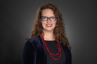
Patricia Solís

Executive Director
Knowledge Exchange for Resilience
480-965-3767
patricia.solis@asu.edu

Tempe Campus

Bio

Patricia Solís, PhD, is Executive Director of the Knowledge Exchange for Resilience at Arizona State University, a campus-wide effort to link multi-sector community needs with research innovations in building community resilience. The effort is funded by a generous grant from the Virginia G. Piper Trust, and engages a multi-disciplinary team of 20 community and academic fellows, 5 cross cutting design scholars, a team of 5 research professors, and a crew of 20 or so full time staff and graduate student assistants. She is Associate Research Professor of Geography in the School of Geographical Sciences and Urban Planning. 

She is Co-Founder and Director of YouthMappers, a rapidly-growing consortium of student-led chapters on more than 208 university campuses in 48 countries who create and use open spatial data for humanitarian and development needs in collaboration with the United States Agency for International Development, the main co-founding sponsor. The network enjoys donors and partners from the non-profit and private sector.

Prior to joining ASU, she was Co-Director of the Center for Geospatial Technology at Texas Tech University and Research Associate Professor of Geography in the Department of Geosciences and affiliated with the TTU Climate Science Center. She served Deputy Director and Director of Research at the American Association of Geographers. Dr. Solís received a BS in Physics, BA in German, and MA in Geography from Kansas State University.  She earned her Ph.D. in Geography from the University of Iowa where she was a Presidential Fellow.  

Solís has developed and executed more than 50 competitive research programs, 80% of them as lead or PI, with funding totaling ~ $18M, promoting innovations in research, education and community collaboration with support from federal agencies such as the US National Science Foundation, the US State Department, NASA, NOAA, US Geological Survey, USAID, and others. Her research focuses on designing experiences for exchanges of knowledge, fellowships, and applications of open geospatial technologies to address socially relevant challenges, from water resource conflict to climate change induced hazards to broadening participation in higher education. Her creative leadership has resulted in the development of collaborative and participatory research methodologies, youth-engaged peer exchanges, new designs for research-centered learning, and the sustained institutionalization of public-private partnerships centered on using digital geographic technologies. 

Education

1998 – 2002     PhD in Geography, University of Iowa

1994 - 1996     Master of Arts in Geography, Kansas State University

1989 - 1994     Bachelor of Science in PhysicsBachelor of Arts in German, Kansas State University

1992 - 1993     Eidgenössische Technische Hochschule (ETH), Zürich, Switzerland

Publications

SELECTED PEER REVIEWED PUBLICATIONS 

Brovelli, Maria Antonia, Marisa Ponte, Sven Shade, and Patricia Solís. 2019. Citizen Science in Support of Digital Earth. In Manual of Digital Earth, Huadong Guo, Michael Goodchild, and Alessandro Annoni (Editors). International Society for Digital Earth. Springer, Singapore, pp. 593-622. DOI: 10.1007/978-981-32-9915-3

Warren, Stacy, Trevor M. Harris, Michael F. Goodchild, and Patricia Solís. 2019. Commentaries on “Evaluating the Geographic in GIS.” (Who is putting whose Geography into whose GIS, and how? Solís). Geographical Review. DOI: 10.1111/gere.12359

Solís, Patricia and Pat DeLucia. 2019. Exploring the impact of contextual information on student performance and interest in open humanitarian mapping. Professional Geographer 71(3):523-535. DOI: 10.1080/00330124.2018.1559655

Solís, Patricia, Niem Tu Huynh, Philippe Huot, Marcela Zeballos, Astrid Ng, and Nwasinachi Menkiti. 2018. Results of an Overdetermined Design for High School Girls’ Learning in Geospatial Technologies for Climate Change.International Research in Geographical and Environmental Education 28(2):151-174. DOI: 10.1080/10382046.2018.1513447.

Coetzee, Serena, Marco Minghini, Patricia Solis, Victoria Rautenbach, and Cameron Green. 2018. Towards Understanding the Impact of Mapathons: Reflecting on YouthMappers Experiences. International Archives of Photogrammetry and Remote Sensing Spatial Information Sciences XLII-4/W8:35-42. DOI: 10.5194/isprs-archives-XLII-4-W8-35-2018.

Hite, Rebecca, Patricia Solís, Lindsay Wargo, and Thomas Barclay Larsen. 2018. Exploring Affective Dimensions of Authentic Geographic Education using a Qualitative Document Analysis of Students’ YouthMappers Blogs. Education Sciences (Special Issue on Authentic Learning) 8(4):173. DOI:10.3390/educsci8040173.

Solís, Patricia, Brent McCusker, Nwasinachi Menkiti, Nuala Cowan, and Chad Blevins. 2018. Engaging Global Youth in Participatory Spatial Data Creation for the UN Sustainable Development Goals: The Case of Open Mapping for Malaria Prevention.Applied Geography 98:143-155.  DOI: 10.1016/j.apgeog.2018.07.013. 

​Solís, Patricia, Niem Tu Huynh, Philippe Huot, Marcela Zeballos, Astrid Ng, and Nwasinachi Menkiti. 2018. Results of an Overdetermined Design for High School Girls’ Learning in Geospatial Technologies for Climate Change.International Research in Geographical and Environmental Education. DOI: 10.1080/10382046.2018.1513447.

Solís, Patricia, Niem Tu Huynh, Daniel Carpenter, Maria Adames de Newbill, and Lynn Ojeda. 2017. Using an Authentic Project Based Learning Framework to support Integrated Geography Education linked to Standards and Geospatial Competencies. Special Issue on Transformative Research in Geographic Education, Research in Geographic Education19(2):36-65.

Solís Patricia, Jenni Vanos and Robert Forbis. 2017. The Decision-making / Accountability Spatial Incongruence Problem for Research linking Science and Policy.  The Geographical Review107(4): 680-704. DOI: 10.1111/gere.12240.

Solís, Patricia, Marie Price, and María Adames de Newbill. 2015. Building Collaborative Research Opportunities into Study Abroad Programs: A Case Study from Panama. Journal of Geography in Higher Education.39(1):51-64. DOI: 10.1080/03098265.2014.996849.

Hawthorne, Timothy, Patricia Solís, Brittney Terry, Marie Price, and Christopher L. Atchison. 2015.  Critical Reflection Mapping as a Hybrid Methodology for Examining Socio-Spatial Perceptions of New Research Sites. Annals of the Association of American Geographers105(1):22-47.

Solís, Patricia and Inés M. Miyares.  2014. Rethinking Practices for Enhancing Diversity in the Discipline.  Featured FOCUS section on Diversity, Inclusion, and Participation in Geography: The Professional Geographer 66(2):169-172.DOI:10.1080/00330124.2012.735920.ISSN: 0033-0124.

Adams, Joy, Patricia Solís and Jean McKendry. 2014. The Landscape of Diversity in U.S. Higher Education Geography. The Professional Geographer 66(2):183-194.DOI:10.1080/00330124.2012.735935. ISSN: 0033-0124.

Solís, Patricia, Joy Adams, Leslie Duram, Susan Hume, Al Kuslikis, Victoria Lawson, Inés M. Miyares, David Padgett, Alex Ramirez. 2014. Diverse Experiences in Diversity at the Geography Department Scale.  The Professional Geographer66(2):205-220.DOI:10.1080/00330124.2012.735940. ISSN: 0033-0124.

Solís, Patricia, et al.  2011. Climate Change and Hazards in the Americas: International Interdisciplinary Research Directions and Opportunities. Washington, DC: Association of American Geographers. Translated and co-authored in Spanish as Cambio Climático y Riesgos en las Américas: Directrices y oportunidades de investigación interdisciplinaria internacional. ISBN 0615408338.  

Solís, Patricia.  2009.  Preparing Competitive Research Grant Proposals.  Chapter in Aspiring Academics:  A Resource Book for Graduate Students and Early Career Faculty*, M. Solem, K. Foote, J. Monk (Editors).  Upper Saddle River, New Jersey: Pearson Prentice-Hall, p. 137-164 ISBN-10:0136048919.

Solís, Patricia.  2005.  Geographic Learning for Sustainable Development.  Chapter in Handbook of Sustainability Research: A contribution from the World Academic Community to the UN Decade of Education for Sustainable Development,Walter L. Filho (Editor).  Frankfurt am Main: Peter Lang GmbH, pp. 679-704. ISBN 0-8204-7308-1.  

Solís, Patricia.  2005.  Water as Rural Heritage: Reworking Modernity through Resource Conflict in Edwards County, Kansas.  Journal of Rural Studies, Volume21, Issue 1, pp. 55-66.ISSN: 0743-0167.

Research Activity: 

CURRENT FUNDED RESEARCH

2020-21    Senior Personnel, RAPID: Active Tracking of Disease Spread in CoVID19 via Graph Predictive Analytics, NSF, PI Gautam Dasarathy, $199.449.

2018-23     Executive Director, Knowledge Exchange for Resilience, a university-community initiative to identify, create, and share the knowledge, experience, and connections to make Maricopa County a national paradigm for building resilient communities through social cohesion, economic prosperity, and environmental security. Principal Investigator Dr. Elizabeth Wentz, Arizona State University. 

2018-23     Principal Investigator, YouthMappers® University Consortium: Building Open Spatial Data for Economic Development and Community Resilience, a study to economic development and community resilience by supporting university students through the rapidly-growing YouthMappers consortium, at the time of award on 120 campuses in 38 countries, to create and use high-quality geospatial data in places of interest to USAID. Emphasis of the effort includes understanding the impact of open mapping on development outcomes, expansion of the student humanitarian movement and quality attribute mapping, and focused efforts on the Let Girls Mapcampaign to address needs of female mappers and women in developing regions. Consortium of Arizona State University, Texas Tech University, West Virginia University, The George Washington University and the Humanitarian OpenStreetMap Team. Awarded by US Agency for International Development, $1,750,000.

2018-21     Principal Investigator, How the Crowdsourced Spatial Data Revolution is Being Used to Complement Official Data (submitted as Blind Spots and Blank Spots: Filling in Knowledge to Harness the Crowdsourced Spatial Data Revolution), a study to advance understanding about the role of open, volunteered spatial data to produce knowledge needed by public institutions for building resilient communities and infrastructure by integrating volunteered spatial data into official cartographies in the US, Mexico and Central America. Awarded by National Science Foundation, Science, Technology and Society Program, $359,244.

2018-20     Principal Investigator, Informal Learning Pathways through Mapathons for Military and Veteran Communities, a study to assess the potential for informal learning events with geospatial technology in the form of mapathons to support military and veteran learners or students to make bridges between competency skills they acquired in service settings and what they can apply in settings related to desired transitions to STEM higher education opportunities or to the civilian workforce. Awarded by National Science Foundation, Advancing Informal STEM Learning, $299,689.

Expertise Areas

Community Resilience 

Geography

International Education

Development 

Data Science 

Citizen Participation

Community Engagement